MCL CSE Market data FRANKFURT: 3ML Investor centre

Properties

Our Properties

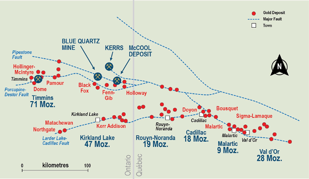
Three gold properties in the Timmins area, on the Abitibi Greenstone Belt.

McCool Property

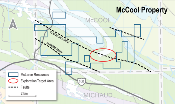
The McCool gold exploration property is located 85 km east of Timmins and covers five kilometres of key geological structure. The property is surrounded by significant gold properties held by Agnico Eagle Mines, McEwen Mining, Mayfair Gold, STLLR Gold and others. McLaren holds a 100 percent interest.

16.5 g/t Au over 6.0 m
Drill highlight reported January 24, 2023
Property facts
Size1,770 ha
Location85 km east of Timmins, Ontario
Ownership100% McLaren Resources
StructureDestor–Porcupine Fault Zone
AccessHighway 101 at the south boundary

History

After exploration by various operators from the 1940s through the 1970s, Placer Dome acquired the property in 1981 and completed several drill programs between 1982 and 1988. McLaren resumed work with IP and ground-magnetic surveys in 2021, followed by exploration diamond drilling in 2022.
Geology

The property is underlain by ultramafic to mafic volcanics with intercalated felsic volcanic and sedimentary rocks. Gold mineralization is associated with quartz veins hosted in strongly altered volcanics and syenite within a structurally complex part of the Abitibi Greenstone Belt.

Exploration

Exploration planning includes geophysical surveys along trend west of the lease area and follow-up drilling along geological strike from the high-grade gold results reported in January 2023. A further geophysical program commenced in 2026.

Past-producing property

Blue Quartz Property

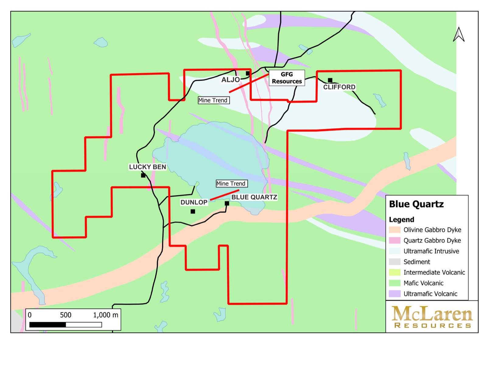
The Blue Quartz property is 73 km east of Timmins and hosts the former Blue Quartz Mine and the southern portion of the former Aljo Mine. It lies eight kilometres north of McEwen Mining’s Fox Mine and ten kilometres west of Mayfair Gold’s Fen-Gibb project, with gravel-road access from Highway 101.

Property facts
Size640 ha
LocationBeatty Township, 73 km east of Timmins
Ownership100% McLaren Resources
Historic minesBlue Quartz and Aljo
Recent workDrone-MAG survey completed in 2026

History

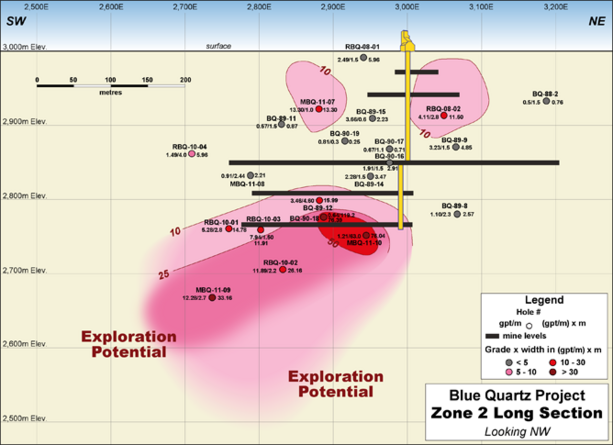
Gold was first discovered on the property in 1907. The Blue Quartz Mine reportedly produced during the 1920s and 1930s from underground workings reached by a 514-foot shaft. The Aljo Mine reportedly produced during the 1940s from workings extending to a depth of 650 feet. Drilling in 2010 and 2011 confirmed further discovery potential.

Geology

The property straddles the Pipestone Fault and the sub-parallel Painkiller Fault. Rocks along both structures are silicified and anomalous in gold. Mapped bedrock is Early Precambrian and forms part of the Abitibi Greenstone Belt.

Exploration

Drill programs have been designed around the Blue Quartz shaft and south of the Aljo shaft. McLaren completed a drone magnetic survey over the property in April 2026 to refine targets for follow-up exploration.

Exploration-stage property

Kerrs Property

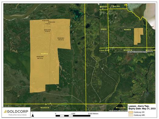
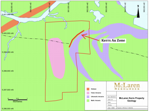
The Kerrs property is approximately 90 km east of Timmins and 20 km north of McEwen Mining’s Fox Mine. It is accessed by a gravel road north from Highway 101. A gold-bearing structure trends southwest onto the property from neighbouring ground with a historic gold resource.

Property facts
Size771 ha
LocationKerrs Township, approximately 90 km east of Timmins
Ownership100% McLaren Resources
TenureMining leases
Historic drilling55 holes totalling 10,279 m

History

Dome Exploration worked the property from 1979 to 1989 and completed 55 drill holes totalling 10,279 metres. Noranda Exploration drilled a southwest-trending mineralized structure on neighbouring ground during the 1980s. A 2011 historical-resource report covered both the former Noranda ground and the Dome property now held by McLaren.

Geology

The dominant rocks belong to the Stoughton–Roquemaure assemblage and consist mainly of south-facing komatiites and magnesium-iron tholeiites. Airborne magnetic data indicate a large antiform, while a quartz porphyry interpreted as an intrusive occurs in the central part of the property.

Exploration

The planned initial exploration phase consists of geophysical surveys over the northern half of the property, extending from the area of historic drilling farther south along geological strike.

Subscribe to our newsletter

News releases and corporate updates, delivered by email.